Walk About (July 2003)
Here is the scenario. I just got laid off after working 4 years at Space Systems Loral. Question is what to do next. Plan A, sit there and sulk over getting laid off. Plan B, take a trip to explore places I wanted to before. After winding down from not having to go to work, it is quite pleasant to go on a vacation. A vacation after a laid off is better than a normal vacation in some ways. You see, in a normal vacation, your mind inevitably wanders back to work every now and then. There is the worry about the deadline that is coming up. You wonder if there are problems with your project that would be uncovered by your co-worker which throws everyone into a panic. Then, there is the worry about loosing favor with the manager because you are taking time off while others are still working hard. With these worries out of the way, you have a true vacation.
I packed the truck with a sleeping bag, some military MRE and off I go. The idea would be to camp in the back of the truck to save money. I would be pretty much self contained for several days. My wife and inlaws agreeded to take care of the baby for me while I am gone. General plan was to go down to coast towards LA, and explore the back country trails along the way. During the trip, there was a strange feeling of being jobless and aimless. Who knows how long I will be out of work. My co-worker had been out for year and a half now. However, I was more relaxed than ever.
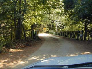
Coast Road
Start: N36.37234 W121.90249 End: N36.28844 W121.84430
This trail starts off of Hwy 1 along the coast near Big Sur. The dirt trail takes you into the hills and canyon, then ends up back on Hwy 1 again. Is a easy drive that could be done in a sedan. It was quite scenic in the back canyons.
Big Sur River
N36.27568 W121.82460
Stop along side of the road at this point to walk down a trail into a nice wide quiet river with crystal clear water. The river runs along the road behind the trees.
Beach Access
N35.94585 W121.47655
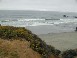
Many remote beachs along the coast are difficult to access. Many of them the beach are quite steep, so that the waves crash down hard on you if you try to enter the water. Near Big Sur, this is a very good shallow beach. It was too cold to swim that day.
Camping by Side of the Road next to the beach.
N35.41419 W120.87389 Along Hwy1 about 5 miles N. of Morro Bay
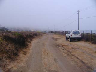
It was difficult to find a place to stop by the side of the road near San Luis Obispo. Most of the pull over locations near the ocean have signs that specify no overnight parking. Here is one location that does not have such a sign, and have easy access to the beach.
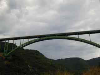
West Camino Cielo Trail
Start of trail: West Camino Cielo Rd off of Hwy154 in Santa Barbara. End of dirt Trail N34.53375 W120.06218 Freeway entrance at Refugio Beach N34.46548 W120.06852
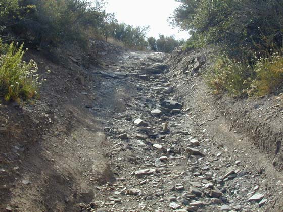
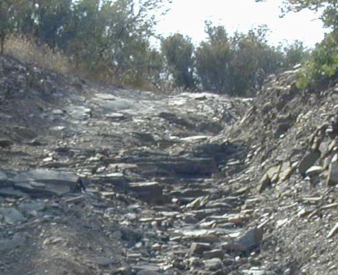
The trail starts in Santa Barbara near the top of the hill. There is East and West Camino Cielo road. West Camino Cielo road is a very winding paved road that goes on along the top of the Santa Barbara mountains. The East Camion Cielo road starts off paved, then turns into dirt after several miles, and is similar to the West except that it is not paved. On the trail, you could see both sides of the mountain since the mountain is quite steep at the top. Most of the trail can be accessed by 2WD truck except near the top where there is one section that will require 4WD. Passenger car can do most of the trail, but will require careful driving.
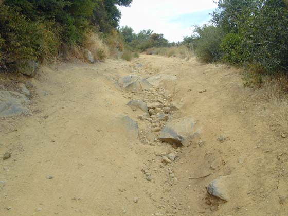
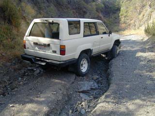
This is the most difficult part of the West Camino Cielo trail. The top left rock in the picture is too high to clear the front of my 2.5" lifted truck if the driver's wheel is climbing on from the center of the rut. If the driver wheel is rolling on the left of the rock, the center will hit the axel. I had to go to the left of the rock climbing on the banks. On the lower part, the rut is quite deep. If a wheel falls into it, the truck would be tiped over quite a bit. Is probably ok, but is too much risk to take being by myself. The rut is much more shallow in the middle portion. The solution is to straddle the rut on the lower portion, then cross over to the left side in the middle portion, and pass the rock on the left side.
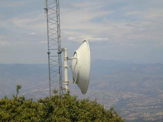
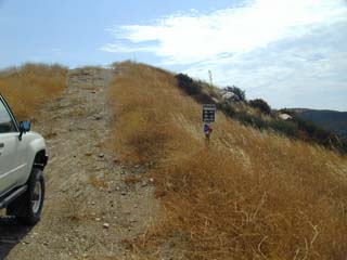
Top of Camino Cielo trail.
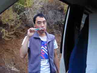 Wake up for another day of
adventure.
Wake up for another day of
adventure.
Boquet Canyon (7/03: Trail is closed due to fire damage. However the gate on the San Francisquito canyon rd is open for some reason.This means, you could only run the trail in the difficult direction. I closed the gate on the San Francisquito side to let others know that the trail is "closed", but is not locked)
20 minutes off of Hwy 5 at Magic Mountain Parkway exit. Trail starts on San Francisquito Canyon Road: N34.58043 W118.45872 End of difficult part of the Boquet canyon trail :N34.55309 W118.44520 From there is fire road. Turn left towards Rowler Flats. Exit fire road on Bouquet Canyon Rd. N34.55373 W118.41362
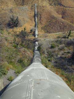 Boquet canyon starts off at the
LA pumping station #1. This is one of the pipe line used to carry fresh water
to the LA cities near the beginning of the trail. Standing on one of the many
pipe lines, you could hear the water rushing past you under your feet.
Boquet canyon starts off at the
LA pumping station #1. This is one of the pipe line used to carry fresh water
to the LA cities near the beginning of the trail. Standing on one of the many
pipe lines, you could hear the water rushing past you under your feet.
Now is time to get into 4WD.
This is the most difficult part of the Boquet Canyon trail.
At the top of the difficult part, there is a deep rut on the right hand side of the trail. I had to pass by on the left side near the bush. The rut on the right side is deep enough to cause possibly tipping. The solid axel Toyota is narrower than the 86' and latter models. My truck has the stock steel rims without offset to widen the truck. That along with the 2.5" lift makes off camber trails scary.
The peak of Boquet Canyon trail. It peaks, then immediately drops back down. Is a sharp hump.
After several more humps, is the end of the difficult section, and meets with a fire road that leads to Boquet Canyon Rd.
On this trip, (7/03) the gate at the Boquet Canyon Rd was locked after making it all the way to it. The sign on the locked gate said the trail was closed for fire damage repair. I was trapped inside, and had to reverse run the trail back to the beginning. It was then that I remembered, I need to return a call for the job at Berkeley. They called me the day before to offer me a job, and my wife took the message. I should call them back in the morning to indicate I am interesting. I also have an interview down in L.A. the next day. I hurried back in hope that the gate will not be locked by a worker who forgot to lock it when I went by. All together, it took about 3 hours to get back. The gate was still open. The next day, Northrope flew my wife down to L.A. I picked her up at the airport. We had a strange dual interview where we both talked to the HR person, then separate to talk to our own group manager. After a week, we found out both my wife and I got the job at Northrope down in L.A. We will have to move down there in September. Now we have to sell our house up here. The idea is to sit out the bad Bay Area economy in L.A. Either that or make L.A. the permanent home.